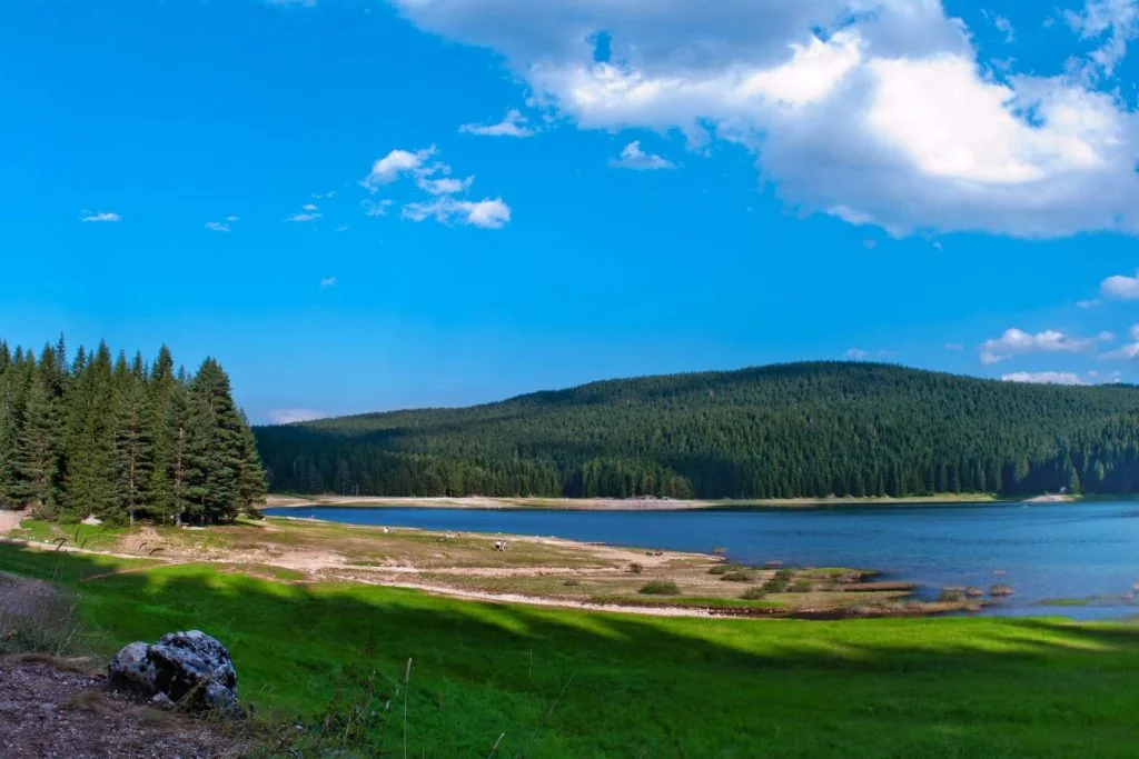
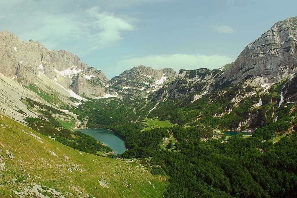
Of the many natural beauties that Durmitor abounds in, a special place is occupied by 18 glacial lakes, known as mountain eyes. The largest, most famous and most attractive is the Black Lake. Explore the full list.
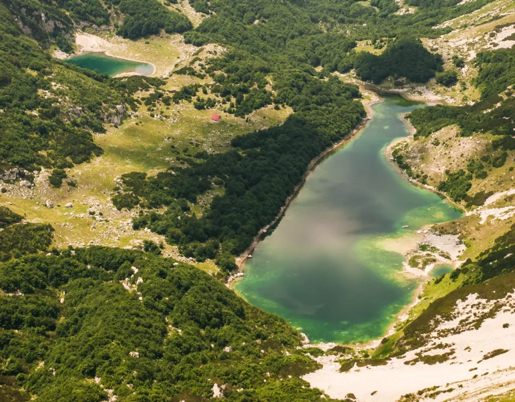
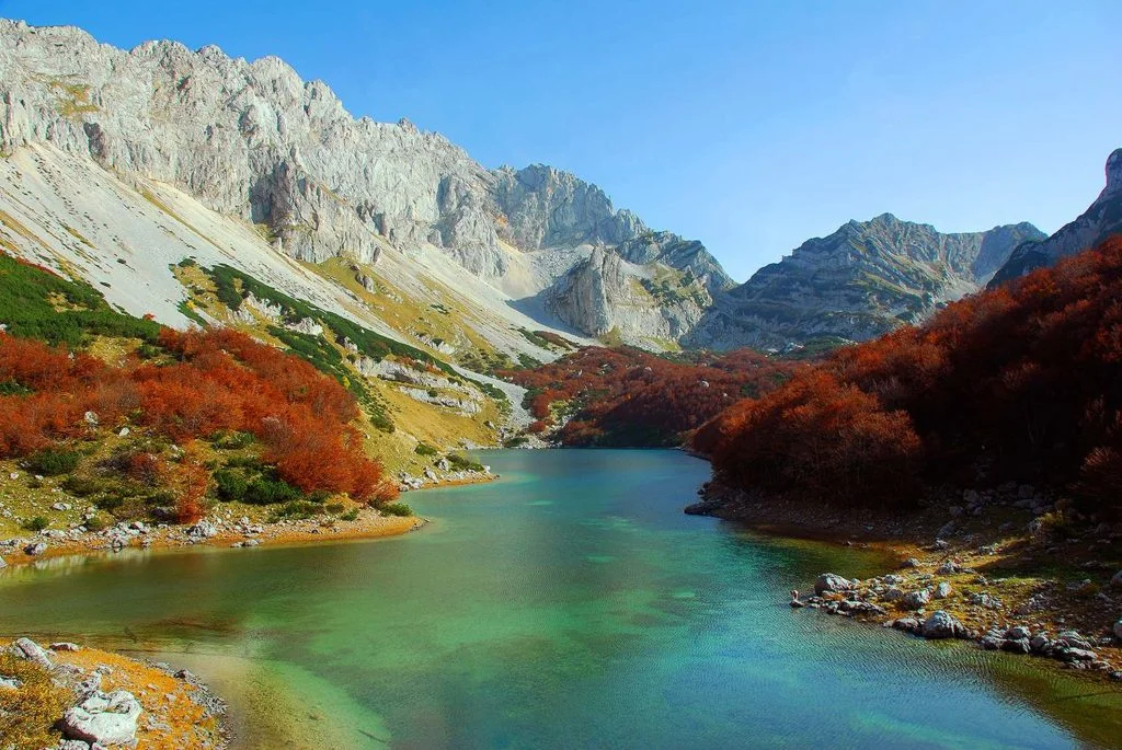
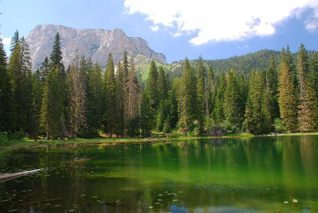
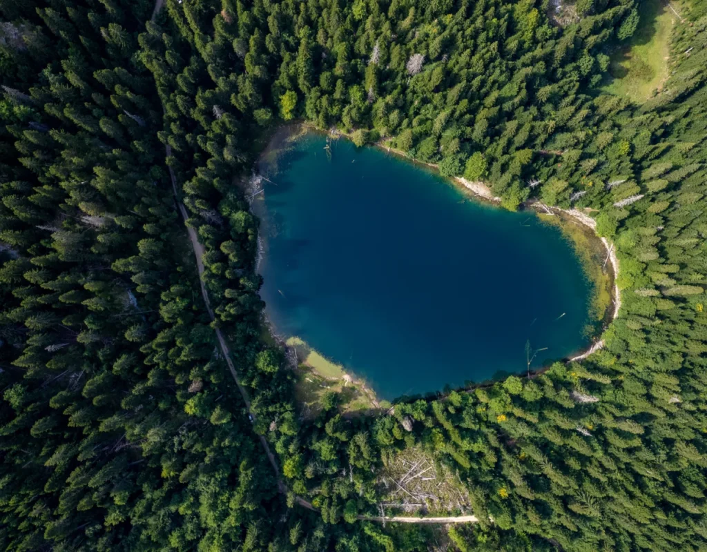
Three kilometers southwest of Žabljak, at 1418 meters above sea level, is CRNO JEZERO, the largest and most famous lake in Durmitor and the second largest among the mountain lakes of Montenegro and one of the symbols of this region. It is part of the "Durmitor" National Park, which is under the protection of UNESCO. It got its name from the coniferous forest reflected in it. According to legend, it was created by Saint Sava to punish disobedient monks who did not adhere to church canons. During the long and harsh winters of Durmitor, the lake is covered with ice for almost the entire winter and then its beauty remains hidden under deep snow. In the spring, when the snow starts to melt from the surrounding mountains, and when the Čelina spring and Mlinski potok work with all their might, the clear mountain water fills the waters of the Small Lake, which then overflow into the Big Lake.
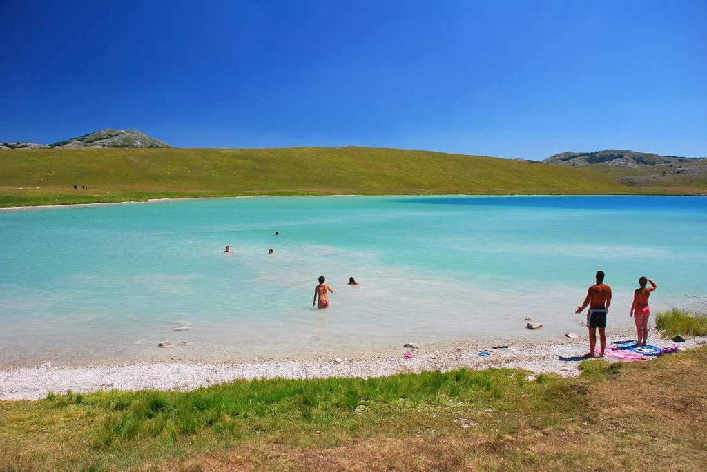
In the summer, the water level of the lake can drop up to 5 meters, and then the waters from the Great Lake return to the Little Lake again. During this period, the water of the lake warms up to the delight of numerous bathers who do not miss the opportunity to dive into the dark waters of the Black Lake. For the less brave, there is a walking trail around the lake, 3.5 km long, full of places where you can enjoy the beautiful pictures of the lake. There you can meet different people from all over the world, all equally refreshed and amazed by the endless beauty of nature.
The depths of the lake also hide many underground passages, through which the water flows further to the Tara and Piva rivers, which represents an exceptional rarity in nature, the so-called bifurcation, the phenomenon that one body of water gives tributaries to two rivers. Whatever reason brings you to the shores of this lake, you will never forget its indescribable beauty and the serenity of the untouched nature that surrounds it.


Lake Sušice is located at the lowest point of the Sušice canyon. This lake dries up completely in the summer months. Depending on the rainfall, and usually until June, the mountains can be reflected on the surface of this lake. In the summer months, only green pastures can be seen in this place. Only with precipitation in the winter period does the lake fill up with water again. Every year the same scene is created.
Depending on the water level, the lake can be 350 to 450 meters long, and the maximum width it can reach is 200 meters. Then the lake is four to five meters deep. It is formed around the river Sušica itself. Part of the lake's water goes through underground channels through porous limestone.


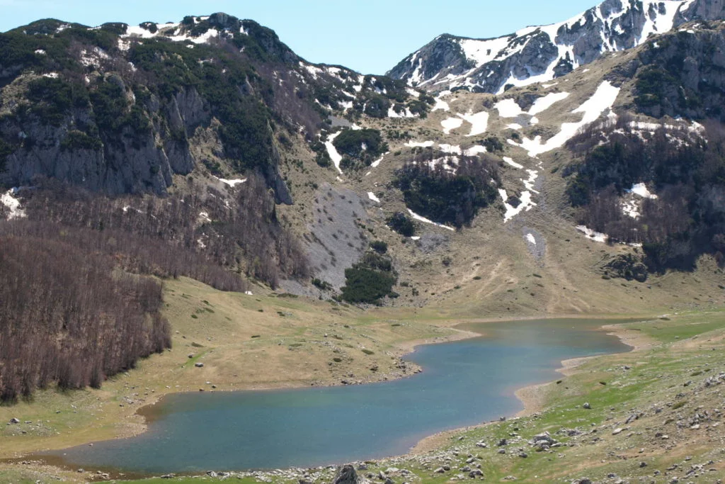
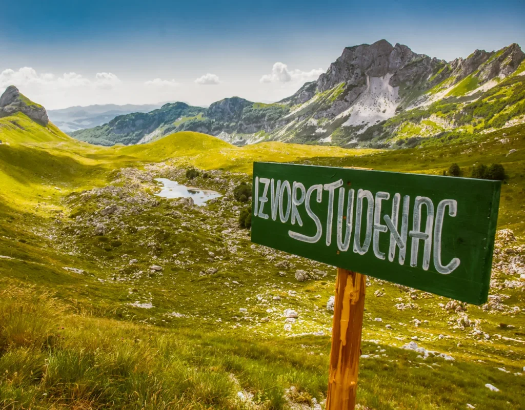
When you start from Žabljak towards Nikšić, on the twelfth kilometer of the old road, there is VRAŽIJE JEZERO, at an altitude of 1411 m, 10.6 m deep, wide open to the sun, it is located on the Jezersko - Drobnjačka surface, next to the main caravan road, which is in the past connected Onogost - Nikšić with Taslidža - Pljevlja.
Why Devil's Lake. There is a nice legend about it. Long ago, the area around the lake was covered with pine forest. One day, a storm caused a forest fire and all the animals that lived in the forest fled to the mountains. Only the devil and his wife escaped at the bottom of the lake, where they built a beautiful castle full of ice crystals. Although Devil's Lake is warmer than other lakes, the coldness of the ice castle can still be felt in the middle of the lake.
It is 500m away from Devil's Lake, located on a part of the lake surface, known as "Grčka strana", at 1409 m above sea level and with a maximum depth of 5.5 m. It got its name from the alleged wealth of fish, especially large specimens. Opposite this lake is the cultural-historical site of the necropolis with medieval tombstones (stećci), which have been on the UNESCO protection list since 2016.


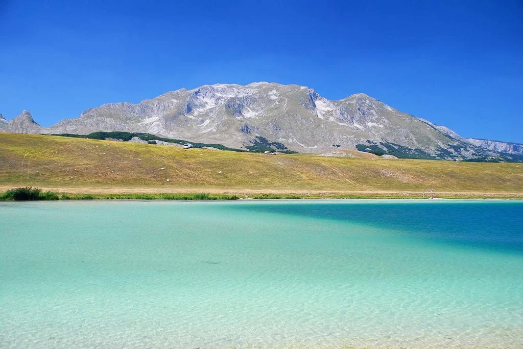
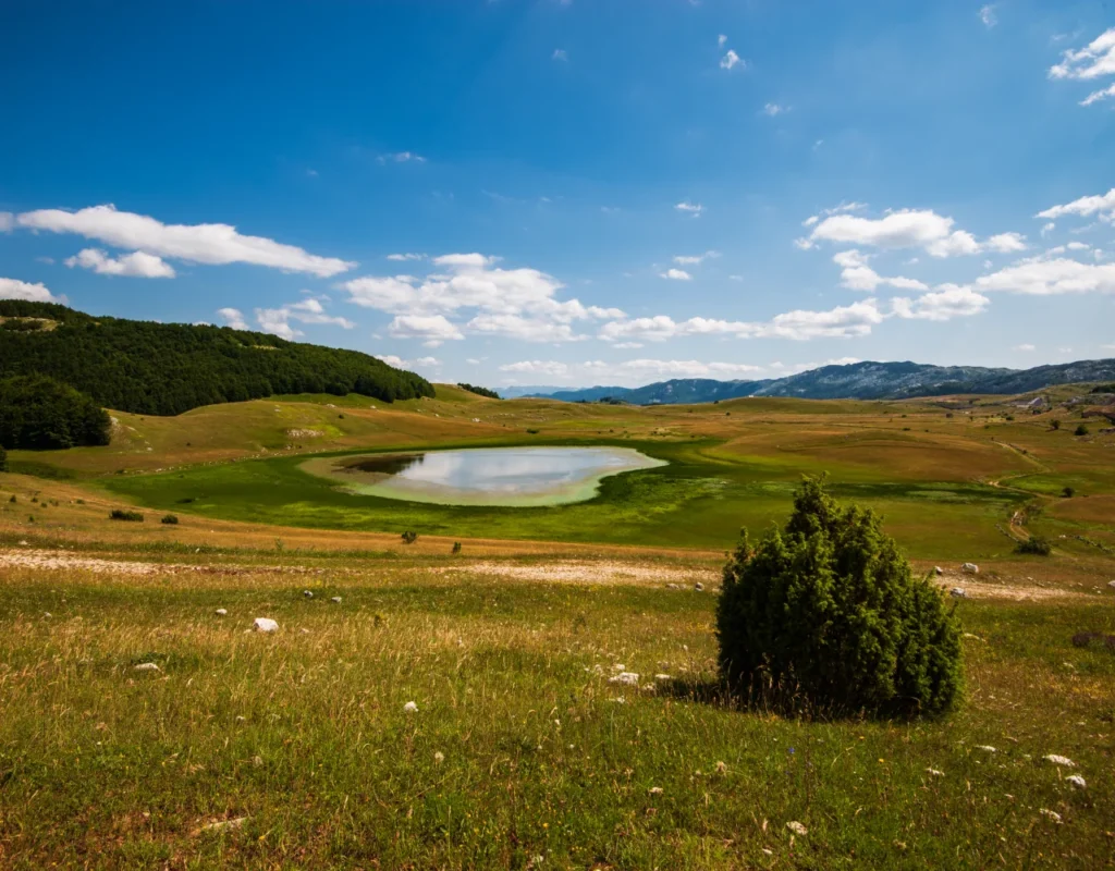
The height of the lake is 1487 m, and the greatest depth is 3.6 meters. As a lake formed in the cirques of the village of Pošćenje during glacial erosion, it attracted the attention of many geologists. Many passers-by, travel writers, scientists, were amazed by the beauty of this lake and the colorful panorama of pastures and forests that surround it.
It is located at the foot of the Durmitor peak called Sedlena greda, at an altitude of 1609 m, while the water depth reaches a maximum of 3.3 meters. When you look at the color of this lake, you will understand how it got its name. There are trout in the lake, and wild ducks often live in it.
This is one of the smallest lakes in Durmitor, with a maximum depth of 1.5 m. The people of Durmitor bathe in its water, believing it to be curative for skin diseases (itching), hence its name.
The mountain lake is located at an altitude of 1690 m above sea level. One look at this lake will be enough to understand why it is called "Valovito".
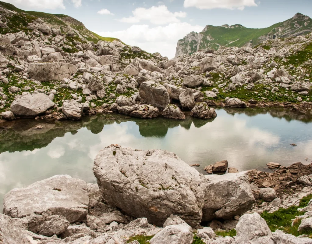
It has an elongated oval shape with steep and rocky banks. The lake is not large: its length is only 225 m, width – 85 m, and the maximum depth is only 3.5 m, while the water is transparent up to 2 m. The water surface is 11600 m², but it is interesting that the surface of the bottom is larger - 12200 m². The water from the lake does not drain, and the excess water evaporates when the weather is warm.
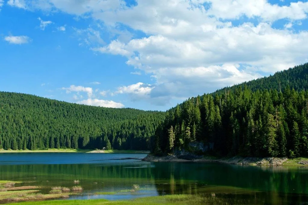
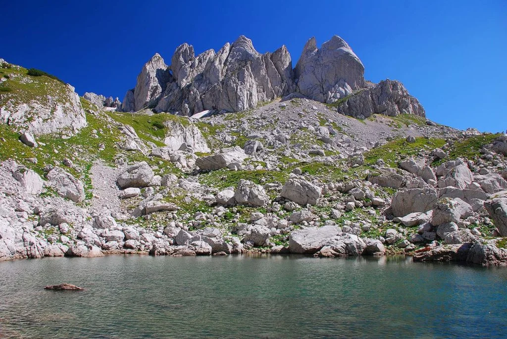
Škrčka jezera (Veliko and Malo) are among the highest hydrographic objects on Durmitor. Veliko jezero lies at 1,700m, and Malo at 1,730m above sea level. They are located in a spacious circus between Prutaš, Šareni pasov and Bobotov kuk. The circus is closed on three sides, so the lakes are difficult to access. The lakes can be reached from Žabljak via Ališnica, next to Bobotovo kuk and Samar.
This route is extremely tiring and can be overcome with 5 to 6 hours of walking. The second approach is from the direction of the Pošćensk region, on the road leading to Trsa. All-terrain vehicles can be used to get to the Shield, and then the area of the Colored Dogs can be reached on foot. The ascent and descent to the Škrčke jezera cirque takes 1 hour.
The color of the water of both lakes is greenish, so the Great Lake is also called the Green Lake.

Lake Jablan is located in Durmitor, about 8 km from Žabljak. It is located at 1791 meters above sea level and can be reached from the Black Lake in about two hours of easy walking. This hiking tour from Black Lake to Jablan Lake is one of the most popular hiking tours of NP Durmitor.

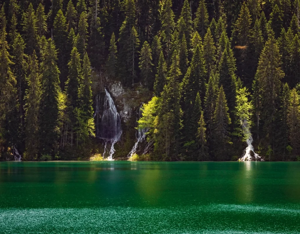
The lake is located near the source of the water that will grow into Mlinski potok. Hidden in the depths of the forest, in the realm of silence, as if intended for meditation. Small in size, planted in a narrow oval belt of spruce, it evokes Gorsko most authentically.
If you have never hiked, you are not in good shape or you are taking children, going to Zminje jezero is a good choice. The road is well marked, at first it goes through a coniferous forest and later on a forest road (which can also be taken by car). In dry weather, you don't even need special shoes, because the road is paved. It takes about an hour and fifteen minutes from Ivan dol.
It is located at an altitude of 1489 m. The lake is small in area, and its sides are overgrown with dense swamp vegetation, while in its surroundings there is a coniferous forest. According to popular belief, the water of this lake is medicinal, especially for skin diseases. The maximum depth of this lake is only one meter. Lake Barno is located in Durmitor at 1489m above sea level near the village of Bosača in Durmitor, which is considered the highest permanently inhabited place in the Balkans.
The mountain lake is located at an altitude of 1285 m, near the village of Zminica at the foot of the Sinjajevina mountain.
Lake Zminičko got its name from the settlement located near it. Coniferous forests and spacious meadows that surround it give it a special charm. Tourists often come here in search of a classic rural landscape.
The lake is 1285 m above sea level, its length is 280 m, and its width is 240 m. The maximum depth is 3.8 m, closer to the shore it is not more than 0.7 m, the water of the lake warms up well in summer. The main source of water in Lake Zminick is spring snowmelt, which is why the lake dries up significantly in the hot season.
In this lake there is a special kind of "human" leeches that are widely used for the purpose of folk medicine. And a large number of wild ducks and other waterfowl live on the shores.
One of the most beautiful lakes in Montenegro. It is located on Mount Sinjajevina and belongs to the Durmitor National Park. It is the choice of many hiking tours and that is why we suggest you visit it.
It starts from Dobrilovina, which is located on the Mojkovac-Đurđevića Tara road. The trail is not too demanding and takes 2 to 2.5 hours (depending on your condition and the number of stops to see something better or take photos).

This is a periodic lake, which forms in the spring months and disappears during the summer, with a maximum depth of 1m. It is located in the very south of the lake plateau, on the border between the municipalities of Šavnica and Zabljačka, near Banski kuća, at an altitude of 1420m. The very name Ševarita lokva speaks of this lake - sevar (reeds overgrown) and lokva (shallow water that, as a rule, dries up in late summer and early autumn).
Zeleni vir is a larger puddle located in the Mlječni dolovi at 1820m above sea level. Its water is clear and green in color and is fed by snow, rain and a small spring. It is an inevitable place to rest on the way to Bobot's hip.
Located in the Pošćen Valley, at 1,594 meters above sea level and only 1.8 kilometers from Lake Pošćen, it reaches a maximum depth of one meter.